Amphoe Mueang Chiang Mai


Amphoe Mueang Chiang Mai


History
The area of Mueang Chiang Mai district was the central part of the Lanna Kingdom, named Nopphaburi Si Nakhon Phing Chiang Mai. King Mengrai the Great was the first king of the Mengrai dynasty, who established the city.The government created Mueang Chiang Mai district in 1899. The first district office was opened in 1929, on the west side of the old city hall of Chiang Mai. A new district office was opened in August 1989.


Geography
Neighboring districts are (from the north clockwise) Mae Rim, San Sai, San Kamphaeng, Saraphi and Hang Dong. The main river through the district is the Ping River.
Administration
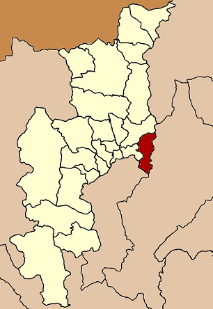
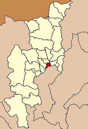
The district is subdivided into 16 subdistricts (tambon), which are further subdivided into 77 villages (muban). The city (thesaban nakhon) Chiang Mai covers the tambon Si Phum, Phra Sing, Haiya, Chiang Moi, Chang Khlan, Wat Ket and Pa Tan, and parts of the tambon Chang Phueak, Suthep, Pa Daet, Nong Hoi, Tha Sala, Nong Pa Khrang and Fa Ham. There are further 3 townships (thesaban tambon) - Chang Phueak covers parts of the tambon Chang Phueak, and Mae Hia and Tha Sala the whole same-named tambon.
Continue Reading...


Amphoe Doi Lo


Amphoe Doi Lo
Geography
Neighboring districts are (from the southwest clockwise) Chom Thong, Mae Wang, San Pa Tong of Chiang Mai Province, Pa Sang and Wiang Nong Long of Lamphun Province

History
The minor district (King Amphoe) was established on April 1 1995, when four tambon were split off from Chom Thong. Following a decision of the Thai government on May 15 2007, all of the 81 minor districts were to be upgraded to full districts. With the publishing in the Royal Gazette on August 24 the upgrade became official.

Administration
The district is subdivided into 4 subdistricts (tambon), which are further subdivided into 54 villages (muban).


Continue Reading...


Amphoe Mae On

0 comments


Geography
The district is located about 40 km east of the city Chiang Mai. Neighboring districts are (from the west clockwise) San Kamphaeng and Doi Saket (Chiang Mai Province), Mueang Pan and Mueang Lampang of Lampang Province, Ban Thi, Mueang Lamphun and Mae Tha of Lamphun Province.
The Mai Ta Khai National Park protecting the source of the Ping River is located in this district.
Mae On is a popular destination for rock climbers who wish to climb the limestone cliffs of Crazy Horse Buttress. Other tourist attractions of the town include natural hot springs and Mae On Cave.

History
The minor district (King Amphoe) was created on April 30 1994, when six tambon were split off from San Kamphaeng district.
Following a decision of the Thai government on May 15 2007, all of the 81 minor districts were to be upgraded to full districts. With the publishing in the Royal Gazette on August 24 the upgrade became official.

Administration
The district is subdivided into 6 subdistricts (tambon), which are further subdivided into 49 villages (muban). There are no municipal (thesaban) areas.


Tham Muang On

Muang On Cave This a large cave easily reach by goodroad 2.5 km from Amphoe Office, A good number of staircase lead you up to the entrance that situated at a certain level, Then a well manage path lead down to a large room plenty of stalagmite and stalagtite.With a spotlight this mervelous stone made a crystal refelt for fancy imagination in middle of the cave a Chedi renovated by Srivichaiya the revered monk in 19 century, Some prehistoric tool found here also evidence of ancient pottery. Waiting for a further research.

ถ้ำเมืองออน

เดิมถํ้าเมืองออนมีชื่อว่าถํ้านมผาหรือถํ้าศิลา มีประวัติความเป็นมาโดยมีครูบาศรีวิชัย นักบุญแห่งล้านนามาบูรณะซ่อมแซมถํ้าแห่งนี้ ในปัจจุบันได้มีการสร้างสถูปของครูบาศรีวิชัยไว้หน้าถํ้าเมืองออนเพื่อให้คนได้บูชากราบไหว้ ภายในถํ้าเมืองออนมีหินงอกหินย้อยที่มีความสวยงามอยู่มากมาย และการเข้าไปชมในถํ้าก็มีความสะดวกสบาย เพราะมีการทำถนนและบันไดไว้บริการอย่างดี มีไฟฟ้าส่องให้ผู้ชมภายในถํ้าอย่างทั่วถึง แสงไฟที่ส่องสะท้อนเกล็ดหินงอกหินย้อยเป็นประกายแวววาวสวยงามยิ่งนัก

ตั้งอยู่หมู่ที่ 2 ตำบลบ้านสหกรณ์ ระยะทางห่างจาก ที่ว่าการกิ่งอำเภอแม่ออนประมาณ 2.5 กิโลเมตร

Continue Reading...


Amphoe Mae Wang

0 comments

Geography
Neighboring districts are (from the south clockwise) Doi Lo, Chom Thong, Mae Chaem, Samoeng, Hang Dong and San Pa Tong of Chiang Mai Province.

History
The minor district (King Amphoe) was established on April 1 1990, when the four tambon Ban Kat, Thung Pi, Thung Ruang Thong and Mae Win were split off from San Pa Tong district. On September 7 1995 it was upgraded to a full district.

Administration
The district is subdivided into 5 subdistricts (tambon), which are further subdivided into 62 villages (muban). Ban Kat is a township (thesaban tambon) which covers parts of the tambon Ban Kat and Don Pao.
Continue Reading...


Amphoe Chai Prakan

0 comments


Geography
Neighboring districts are (from the south clockwise) Phrao, Chiang Dao, Fang of Chiang Mai Province and Mae Suai of Chiang Rai Province.

History
The minor district (King Amphoe) Chai Prakan was created on January 1 1988, when four tambon were split off from Fang district.It was upgraded to a full district on July 4 1994.

Administration
The district is subdivided into 4 subdistricts (tambon), which are further subdivided into 43 villages (muban). Chai Prakan itself is a township (thesaban tambon) which covers parts of the tambon Pong Tam, Si Dong Yen and Nong Bua.
Continue Reading...


Amphoe Wiang Haeng

0 comments


History
The area of tambon Wiang was very far from Chiang Dao district center. The government separated Tambon Mueang Ngae and Piang Luang to create a minor district (King Amphoe) on May 5th, 1981. It was upgraded to a full district on November 4th, 1993.

Geography
Neighboring districts are (from the northeast clockwise) Chiang Dao of Chiang Mai Province, Pai of Mae Hong Son Province and Shan State of Myanmar.

Administration
The district is subdivided into 3 subdistricts (tambon), which are further subdivided into 26 villages (muban).


Continue Reading...


Amphoe Saraphi

0 comments


Geography
Saraphi borders the districts (from west clockwise) Hang Dong, Mueang Chiang Mai, San Kamphaeng of Chiang Mai Province, Mueang Lamphun of Lamphun Province.

History
The district was established in 1891, then named Yang Noeng (ยางเนิ้ง). In 1927 it was renamed to Saraphi.

Administration
The district is subdivided into 12 subdistricts (tambon), which are further subdivided into 105 villages (muban). Yang Noeng is a township (thesaban tambon) which covers parts of the tambon Yang Noeng, Saraphi and Nong Phueng. The township Saraphi covers further parts of tambon Saraphi.


Continue Reading...


Amphoe Omkoi

0 comments


Geography

Neighboring districts are (from the north clockwise) Hot, Doi Tao of Chiang Mai Province, Sam Ngao, Mae Ramat Tha Song Yang of Tak Province and Sop Moei of Mae Hong Son Province.

History
The minor district (King Amphoe) was established in 1920 as a subordinate of Hot district. It was upgraded to a full district on July 23 1958.

Administration
The district is subdivided into 6 subdistricts (tambon), which are further subdivided into 95 villages (muban). Omkoi is a township (thesaban tambon) which covers parts of the tambon Omkoi.


Continue Reading...


Amphoe Doi Tao

0 comments


Geography
Neighboring districts are (from the west clockwise) Om Koi, Hot of Chiang Mai Province, Li of Lamphun Province and Sam Ngao of Tak Province.

History
The minor district (King Amphoe) was established on October 16 1972 by splitting off the four tambon Tha Duea, Doi Tao, Muet Ka and Ban Aen from Hot district. It was upgraded to a full district on March 25 1979.

Administration
The district is subdivided into 6 subdistricts (tambon), which are further subdivided into 42 villages (muban). Tha Duea is a township (thesaban tambon) which covers parts of the tambon Tha Duea and Mueat Ka.


Continue Reading...


Amphoe Hot

0 comments


Geography
Neighboring districts are (from the north clockwise) Mae Chaem, Chom Thong of Chiang Mai Province, Ban Hong, Li of Lamphun Province, Doi Tao, Omkoi of Chiang Mai Province again, Sop Moei and Mae Sariang of Mae Hong Son Province.

Administration
The district is subdivided into 6 subdistricts (tambon), which are further subdivided into 60 villages (muban). There are two townships (thesaban tambon) - Tha Kham and Hang Dong, both covering parts of tambon Hang Don.


Continue Reading...


Amphoe Hang Dong

0 comments


Geography
Neighboring districts are (from the southwest clockwise) San Pa Tong, Mae Wang, Samoeng, Mae Rim, Mueang Chiang Mai, Saraphi of Chiang Mai Province and Mueang Lamphun of Lamphun Province.
To reach Baan Tawaii. (famous Handicraft center) you turn left just after Hang Dong market if you are driving from Chiang Mai.

Administration
The district is subdivided into 11 subdistricts (tambon), which are further subdivided into 113 villages (muban). Nong Thong Phattana is a township (thesaban tambon), which covers parts of tambon Nong Thong.


Continue Reading...


Amphoe San Sai

0 comments

History
In the rainy season, the Ping and Khao rivers bring a lot of sand to accumulate at the area of the rivers join together year by year. It happens a big sand dune. Now the area is the location of San Sai district office. When the government created the district in this area on October 20th, 1897, they selected name San Sai. San means Dune and Sai means Sand.

Geography
Neighboring districts are (from the north clockwise) Mae Taeng, Doi Saket, San Kamphaeng, Mueang Chiang Mai and Mae Rim and of Chiang Mai Province.

Administration
The district is subdivided into 12 subdistricts (tambon), which are further subdivided into 116 villages (muban). There are two townships (thesaban tambon) - San Sai Luang covers parts of tambon San Sai Luang, San Sai Noi, San Phranet and Pa Phai; and Mae Cho parts of tambon Nong Chom, Nong Han and Pa Phai.


Continue Reading...


Amphoe San Kamphaeng

0 comments


Geography
San Kamphaeng borders the districts (from west clockwise) Saraphi, Mueang Chiang Mai, San Sai, Doi Saket, Mae On of Chiang Mai Province and Ban Thi of Lamphun Province.

History
The district goes back to the Kwaeng Mae Om, which was established in 1902. In 1923 the district was renamed to San Kampaeng.

Economy
San Kamphaeng is famous for its many silk factories. Along the road from Chiang Mai to San Kamphaeng are many handicraft shops selling traditional Thai items to tourists, like the umbrellas of Bo Sang.

Administration
The district is subdivided into 10 subdistricts (tambon), which are further subdivided into 100 villages (muban). There are two townships (thesaban tambon) - San Kamphaeng covers parts of tambon San Kamphaeng and Chae Chang, and the whole tambon Sai Mun; and Ton Pao covers the whole tambon Ton Pao.


Continue Reading...


Amphoe San Pa Tong

0 comments


Geography
Neighboring districts are (from the southwest clockwise) Doi Lo, Mae Wang, Hang Dong of Chiang Mai Province, Mueang Lamphun and Pa Sang of Lamphun Province

Administration
The district is subdivided into 11 subdistricts (tambon), which are further subdivided into 121 villages (muban). There are two townships (thesaban tambon) - San Pa Tong covers parts of tambon Yu Wa, Makham Luang and Thung Tom; and Ban Klang which covers parts of Ban Klang, Tha Wang Phrao, Makham Luang and Ma Khun Wan.


Continue Reading...


Amphoe Mae Rim

0 comments

Geography
Neighboring districts are (from the north clockwise) Mae Taeng, San Sai, Mueang Chiang Mai, Hang Dong and Samoeng of Chiang Mai Province.

Administration
The district is subdivided into 11 subdistricts (tambon), which are further subdivided into 91 villages (muban). Mae Rim is a township (thesaban tambon), which covers parts of tambon Rim Tai and Mae Sa.


Continue Reading...


Amphoe Phrao

0 comments


Geography
Neighboring districts are (from the south clockwise) Doi Saket, Mae Taeng, Chiang Dao, Chai Prakan of Chiang Mai Province, Mae Suai and Wiang Pa Pao of Chiang Rai Province.

Administration
The district is subdivided into 11 subdistricts (tambon), which are further subdivided into 108 villages (muban). Wiang Phrao is a township (thesaban tambon), which covers parts of tambon Wiang and the whole Thung Luang.
Continue Reading...


Amphoe Mae Ai

0 comments


History
The minor district (King Amphoe) Mae Ai was created on August 15th, 1967, when the three tambon Mae Ai, Mae Sao and Mae Na Wang were separated from Fang district. It was official upgraded to a full district on June 28th, 1973.

Geography
Neighboring districts are (from the southwest clockwise) Fang of Chiang Mai Province, Sha
State of Myanmar, Mae Fa Luang, Mueang Chiang Rai and Mae Suai of Chiang Rai Province.
The important rivers are the Kok and Fang river.

Administration
The district is subdivided into 7 communes (tambon), which are further subdivided into 110 villages (muban). Mai Ai is also a township (thesaban tambon), which covers parts of the tambon Mae Ai and Malika.


Continue Reading...


Amphoe Fang

0 comments

History
According to the Yonok chronicle, Mueang Fang was built in 641 by King Lawa Changkarat. Later King Mengrai the Great reigned Fang before building Wiang Kumkam and Chiang Mai of Lanna Kingdom. In 1910 the Mueang Fang was made a subordinate of Chiang Rai, then named Mueang Fang district. In 1925 it was reassigned to Chiang Mai. 1938 it the word Mueang was cut off from the name, which was then reserved for the capital districts on the provinces.

Etymology
The landscape of Mueang Fang looked like the seed of a Fang tree (Caesalalpinia sappan). Thus the town was named after the tree.

Geography
Neighboring districts are (from the northeast clockwise) Mae Ai of Chiang Mai Province, Mae Suai of Chiang Rai Province, Chai Prakan of Chiang Mai Province again and Shan State of Myanmar.
The Doi Phahompok National Park is located in Fang district.

Administration
The district is subdivided into 8 subdistricts (tambon), which are further subdivided into 128 villages (muban). There are two townships (thesaban tambon) - Wiang Phrao covers parts of tambon Wiang, and Ban Mae Kha parts of tambon Mae Kha.
Continue Reading...


Amphoe Samoeng

0 comments

Geography
Neighboring districts are (from the north clockwise) Mae Taeng, Mae Rim, Hang Dong, Mae Wang, Mae Chaem of Chiang Mai Province and Pai of Mae Hong Son Province.

History
The district was originally created in 1902. At first it was a minor district (King Amphoe), which was upgraded to a full district in 1908. 1938 it was again downgraded to a minor district, and upgraded back to a full district 1958

Administration
The district is subdivided into 5 subdistricts (tambon), which are further subdivided into 45 villages (muban). Samoeng Tai is a township (thesaban tambon), which covers parts of tambon Samoeng Tai.


Continue Reading...


Amphoe Mae Taeng

0 comments


Geography
Neighboring districts are (from the north clockwise) Chiang Dao, Phrao, Doi Saket, San Sai, Mae Rim, Samoeng of Chiang Mai Province and Pai of Mae Hong Son Province.

History
1892 the Khwaeng Mueang Kuet (เมืองกื้ด) was created, which was changed in 1894 to Khwaeng Mueang Kaen (เมืองแกน). In 1907 it was converted to the district (Amphoe) named San Maha Phon (สันมหาพน). It was renamed to Mae Tang in 1939.


Administration
The district is subdivided into 13 subdistricts (tambon), which are further subdivided into 128 villages (muban). There are two townships (thesaban tambon) - San Maha Phon covers parts of tambon San Maha Phon and Khilek; Mueang Kaen Phatthana covers the whole tambon Cho Lae and parts of Intha Khin.


Continue Reading...


Amphoe Doi Saket

0 comments


Geography
Neighboring districts are (from the south clockwise) Mae On, San Kamphaeng, San Sai, Mae Taeng, Phrao of Chiang Mai Province, Wiang Pa Pao of Chiang Rai Province and Mueang Pan of Lampang Province.

Life Style
The district is basically a rural farming area. Including rice fields on the valley floor with orchards and mixed farming on the hillsides. The village proper is located just minutes drive from Chiang Mai city center. It has some service providers for chiang mai city, like a commercial laundry that does sheets and towels for the hotel industry and concrete readimix and the like. However the main economics is mostly farming and some people work in the city as day workers. The village is most famous with Thai tourists for it mordern style wall murals at Wat Doi Saket.

Administration
The district is subdivided into 14 subdistricts (tambon), which are further subdivided into 110 villages (muban). Doi Saket is a township (thesaban tambon), which covers parts of tambon Choeng Doi and Luang Nuea.
Continue Reading...


Amphoe Chiang Dao

0 comments


Geography
Neighboring districts are (from the northeast clockwise) Fang, Chai Prakan, Phrao, Mae Taeng of Chiang Mai Province, Pai of Mae Hong Son Province, and Wiang Haeng of Chiang Mai again. To the north is the Shan State of Myanmar.
The Pha Daeng National Park is located in the district.

Administration
The district is subdivided into 7 subdistricts (tambon), which are further subdivided into 91 villages (muban). Both Chiang Dao and Mueang Ngai are townships (thesaban tambon), which cover parts of the same-named tambon.
Continue Reading...


Amphoe Mae Chaem

0 comments

History
The district Mueang Chaem was created in 1908,[1] consisting of the tambon Mae Thap,Tha Pha, Chang Khoeng and Mae Suek split off from Chom Thong. In 1917 it was renamed to Chang Khoeng, as the district office was located in that tambon.[2] In 1938 it was reduced to a minor district (King Amphoe) and was a subordinate of Chom Thong district.[3] 1939 it was renamed to Mae Chaem.[4] In 1956 it was upgraded to a full district.[5]

Geography
Neighboring districts are (from the east clockwise) Samoeng, Mae Wang, Chom Thong and Hot of Chiang Mai Province, and Mae Sariang, Mae La Noi, Khun Yuam, Mueang Mae Hong Son and Pai of Mae Hong Son Province.
Topography and vegetation
Sharp relief and forest vegetation characterize the Mae Chaem basin. The basin has a wide range of elevation, from 282 m.a.s.l. at its lowest point to 2,565 m.a.s.l. at its highest peak, Doi Inthanon, which is also the highest mountain of all Thailand. Altitude variation induces different climatic zones with distinctive types of natural landcover. Dominant vegetation includes dry dipterocarp and mixed deciduous forests below 1,000 m.a.s.l., tropical mixed pine forest from 900 – 1,500 m.a.s.l. alternating with hill evergreen forest that extends up to 2,000 m.a.s.l., and tropical montane cloud forest above 2,000 m.a.s.l. Steep hillsides with slopes exceeding 25% are a common landscape element, resulting in rates of soil erosion that prevent advanced soil development. Thus, soils are relatively shallow and have limited water-holding capacity. Dominant soil textures are sandy clay loam and clay loam.
Administration
The district is subdivided into 10 subdistricts (tambon), which are further subdivided into 131 villages (muban). Mae Chaem also has township (thesaban tambon) status and covers parts of tambon Chang Khoeng.
Continue Reading...


Amphoe Chom Thong

0 comments

 Amphoe_5002.svg

Amphoe Chom Thong


History

According to the legend of Wat Phra That Si Chom Thong Worawihan, the location of the temple is on a small hill which looks similar to a termite hill (Chom Pluak in Thai). The hill is covered by Thong Kwao or Bastard teak (Butea monosperma) and Thong Lang or Coral trees (Erythrina variegata) forest. Thus the people called the hill Chom Thong.

After Lord Buddha entered parinirvana, King Asoka the Great visited the hill to place Buddha's relics there. The temple was built on the hill and named Wat Phra That Chom Thong in 1451. Later the temple was upgraded to be Royal temple and at the same time renamed to Wat Phra That Si Chom Thong Worawihan.

The government created a district in the area in 1900 and named the new district Chom Thong following the legend. The district office was originally located in Ban Tha Sala, Tambon Khuang Pao. In 1933 the office was moved to the southwest of Wat Phra That Chom Thong.

Geography

Neighboring districts are (from the south clockwise) Hot, Mae Chaem, Mae Wang, Doi Lo of Chiang Mai Province, Wiang Nong Long and Ban Hong of Lamphun Province.

The important river is the Ping River.

The Doi Inthanon National Park is located in the district.


Administration
The district is subdivided into 6 subdistricts (tambon), which are further subdivided into 96 villages (muban). Chom Thong is a township (thesaban tambon), which covers parts of tambon Ban Luang, Khuan Pao and Doi Kaeo.

Tourism

Doi Inthanon

Doi Inthanon (Thai: ดอยอินทนนท์(Pronunciation)) is the highest mountain in Thailand. It is located in Mae Chaem District. The mountain was also known in the past as Doi Luang (meaning big mountain) or Doi Ang Ka, meaning the crow's pond top. Near the mountain's base was a pond where many crows gathered. The name Doi Inthanon was given in honour of the king Inthawichayanon, one of the last kings of Chiang Mai, who was concerned about the forests in the north and tried to preserve them. He ordered that after his death his remains shall be placed at Doi Luang, which was then renamed.

Chom Thong1  Place_WFVajiradhara


From Wikipedia, the free encyclopedia

Continue Reading... Labels: ,


Northern Thai language

0 comments


Northern Thai language

The Northern Thai language or Kham Mueang (คำเมือง) is the language of the Thai Yuan people of Lannathai, Thailand. It is a Tai language, closely related to Thai and Lao. Northern Thai has approximately six million speakers, most of whom live in Thailand, with a few thousand in northwestern Laos.

Speakers of this language generally consider the name Yuan to be pejorative. They generally call themselves Khon Muang (คนเมือง) (or Lannathai or Northern Thai). The language is generally known by one of these terms, or as Phayap. The term Yuan is still used for the distinctive Lannathai script, which is closely related to the old Thai Lue alphabet and the Lao religious alphabets. It also resembles the Burmese and Mon alphabets. (All these alphabets derive from the Old Mon alphabet.) The use of the tua mueang, as the traditional alphabet is known, is now largely limited to Buddhist temples, where many old sermon manuscripts are still in active use. There is no active production of literature in the traditional alphabet.

Most linguists consider Northern Thai to be more closely related to Thai and the other Chiang Saeng languages than to Lao and the Lao-Phutai languages, but the distinction is never easy to make, as the languages form a continuum with few sharp dividing lines.

Vocabulary

Different words

Many words differ from central Thai greatly.

ยี่สิบ > ซาว (yi sip > sao, twenty)

พูด > อู้ (phut > u, speak)

พี่ชาย > อ้าย (phi chai > ai, older brother)

Similar words

Some words differ in tone only.

หนึ่ง > นึ่ง (nueng, one)

หก > ฮก (hok, six)

เจ็ด > เจ๋ด (chet, seven)

สิบ > ซิบ (sip, ten)

เป็น > เป๋น (pen, be)

กิน > กิ๋น (kin, eat)

Some words differ in a single sound and associated tone. In many words, the initial ร (r) is spoken as ฮ (h).

ร้อน > ฮ้อน (ron > hon, hot)

รัก > ฮัก (rak > hak, love)

รู้ > ฮู้ (ru > hu, know)

เชียงราย > เจียงฮาย (Chiang Rai > Jiang Hai, Chiang Rai city and province)

คิด > กึ๊ด (khit > kit, think)

ช้อน > จ๊อน (chon > *jon, spoon) *Both initials are transcribed ch in RTGS.

ใช้ > ใจ๊ (chai > *jai, use)

ให้ > หื้อ (hai > hue, give, let)

พ่อ > ป้อ (pho > po, father)

โกรธ > โขด (krot > khot, (be) angry)


Continue Reading... Labels: ,


Chiang Mai History

0 comments


Chiang Mai1

Chiang Mai History


King Mengrai founded the city of Chiang Mai (meaning "new city") in 1296, and it succeeded Chiang Rai as capital of the Lannathai kingdom. Mengrai constructed a moat and a wall around the city to protect it against raids from Burma. With the decline in power of the Lannathai kingdom, the city lost importance and often was occupied by either the Burmese or Thais from Ayutthaya. As a result of the Burmese wars that ended with the fall of Ayutthaya in April 1767, Chiang Mai was so depopulated that its remaining inhabitants abandoned the city from 1776 to 1791. During that time, Lampang functioned as the capital of what remained of Lannathai.

Chiang Mai formally became part of Siam in 1774, when the Thai King Taksin captured it from the Burmese. Chiang Mai rose in both cultural, trading and economic terms to adopt its current status as the unofficial capital of the north of Thailand, second only in national importance to Bangkok.

The people generally speak Kham Muang (also known as Northern Thai or Lanna) amongst themselves, but the Central Thai of Bangkok is used in education and is understood by most. The old Kham Muang alphabet is now only studied by scholars and Northern Thai is commonly written using the standard Thai alphabet.

The modern municipal entity dates back to a sanitary district (sukhaphiban) created in 1915. It was upgraded to a municipality (thesaban) on March 29 1935, as published in the Royal Gazette, Book No.52 section 80. At first covering an area of 17.5 km² (7 sq mi), it was enlarged to cover 40.216 km² (16 sq mi) on April 5, 1983.

Chiang Mai2

Continue Reading... Labels:


Chiang Mai

0 comments


Chiang Mai
Chiang Mai (เชียงใหม่) is the hub of Northern Thailand. With a population of over 170,000 in the city proper (but more than 1 million in the metropolitan area), it is Thailand's fifth-largest city. Located on a plain at an elevation of 316 m, surrounded by mountains and lush countryside, it is much greener and quieter than the capital, and has a cosmopolitan air and a significant expat population, factors which have led many from Bangkok to settle permanently in this "Rose of the North".

Understand

Founded in 1296 AD, Chiang Mai is a culturally and historically interesting city, at one time the capital of the ancient Lanna kingdom. Located among the rolling foothills of the Himalayan Mountains 700 km north of Bangkok, it could only be reached by an arduous river journey or an elephant back trip until the 1920s. This isolation helped preserve Chiang Mai's distinctive charm intact to this day.

Chiang Mai's historical centre is the walled city (City is chiang in the northern Thai dialect while 'mai' is new, hence Chiang Mai - "New City"). Sections of the wall dating to their restoration a few hundred years ago remain at the gates and corners, but of the rest only the moat remains.

Inside Chiang Mai's remaining city walls are more than 30 temples dating back to the founding of the principality, in a combination of Burmese, Sri Lankan and Lanna Thai styles, decorated with beautiful wood carvings, Naga staircases, leonine and angelic guardians, gilded umbrellas and pagodas laced with gold filigree. The most famous is Wat Phrathat Doi Suthep, which overlooks the city from a mountainside 13 km away.

Modern-day Chiang Mai has expanded in all directions, but particularly to the east towards the Ping River (Mae Nam Ping), where Thanon Chang Klan, the famous Night Bazaar and the bulk of Chiang Mai's hotels and guesthouses are located.Loi Kroh Rd is the center of the city's nightlife . The locals say you've not experienced Chiang Mai until you've seen the view from Doi Suthep, eaten a bowl of kao soi, and purchased an umbrella from Bo Sang. Of course this is touristic nonsense, but the Kao Soi, Bo Sang umbrellas and Doi Suthep are important cultural icons for Chiang Mai residents. Ratchadamneon Rd hosts the main Sunday night walking street market from Thapae Gate to the popular Wat Phra Singh.


From Wikipedia, the free encyclopedia
Continue Reading... Labels:


Random Posts

Recent Comments

About Template

Return to top of page Copyright © 2010 | Flash News Converted into Blogger Template by HackTutors